A Wheelchair User’s Day in Bath: Routes, Rest Stops and the Slopes Nobody Mentions
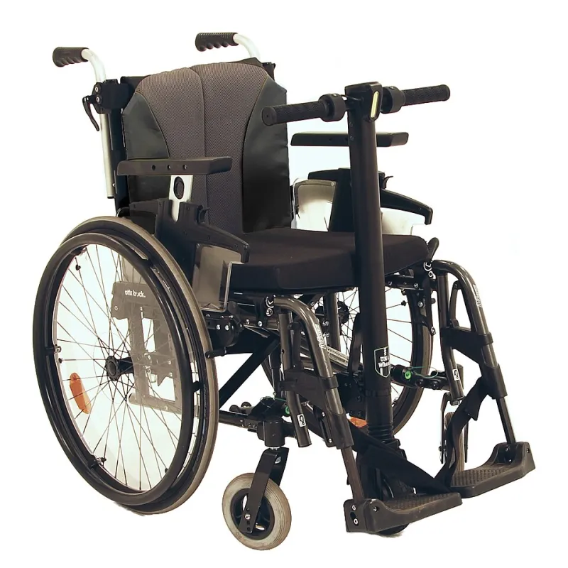
Photo: Nick Yudin, CC BY-SA 4.0, via Wikimedia Commons
Bath is often described as a walking city, which can sound unwelcoming if walking is not your main way of getting around. In practice, the city can be a rewarding day out for a scooter or powered wheelchair user, provided the day is built around Bath’s shape rather than a list of attractions. The centre is compact, but the city sits in a bowl. Roads climb quickly away from the river, and pavements change from smooth flagstones to cobbles, setts and gravel within a few streets. A calm itinerary therefore starts with three questions: where will I arrive, where will I charge, and which slope am I willing to take once rather than three times?
Begin at the edge, not at the Abbey
A common mistake is to arrive in the middle of the city and then try to work outwards. A better approach is to start at a known access point with toilets, lifts and a reliable exit. SouthGate car park is a sensible starting point for many visitors, with accessible bays and lifts, and it places you within a short distance of the Abbey and the main shopping streets. If you are arriving by train, Bath Spa station is step-free, but the approach and the surrounding pavements still need to be considered at busy times.
From SouthGate, keep the first hour simple. Use Kingston Parade and the smoother side of the Abbey precinct rather than attempting every cobbled corner. The Abbey exterior is worth seeing, but the churchyard and surrounding lanes can be uneven and crowded. Treat the first hour as a settling-in period: check your battery level, note where the nearest accessible toilet is, and decide whether the pavements are drier or more crowded than expected.
A workable shape for the day
A relaxed day in Bath does not need to include everything. The following shape works because it keeps the climbs limited and leaves room for rest.
- 10:30 — Arrive and settle. Use SouthGate or another central access point with accessible parking. Begin with the Abbey exterior and Kingston Parade.
- 11:15 — Optional garden stop. Parade Gardens can be pleasant if the entrance and opening arrangements suit your aid; confirm before you rely on it. If the route or the weather is doubtful, skip it without guilt.
- 12:00 — Lunch with a purpose. Book a venue that has step-free access, an accessible toilet and, ideally, a socket where you can charge over lunch. Ask about door widths and table heights when booking.
- 13:30 — Great Pulteney Street and the Holburne Museum. The route is relatively level compared with the northern hills, though pavements are narrow in places. The Holburne has accessible facilities and a café; confirm current arrangements before travelling.
- 15:00 — Royal Victoria Park. Use the tarmac paths rather than gravel tracks, especially after rain. Autumn leaves and wet gravel can make braking less predictable.
- 16:00 — Return slowly. Keep a battery reserve for the journey back and for any unexpected diversion.
This is not a rigid schedule. Its purpose is to avoid the familiar pattern of trying to see one more thing and then finding yourself at the bottom of a hill with a low battery.
The slopes and surfaces that catch people out
Bath’s topography is the main issue. Milsom Street is manageable for many scooter users but tiring; Gay Street is steeper; Lansdown Road and Bathwick Hill are best avoided unless your route genuinely requires them. Widcombe Hill and Wells Road are long climbs. The approach to Pulteney Bridge is narrow and busy, and crossing requires patience rather than speed.
Surfaces matter as much as gradients. Parts of the city centre have cobbles and setts, which can be uncomfortable and can affect traction. Flagstones may be uneven where tree roots have lifted them. Royal Victoria Park has tarmac paths and some gravel; after rain, gravel and leaves can reduce grip. In winter, frost and wet leaves make even gentle slopes more demanding. If your scooter has solid tyres, the difference between a smooth pavement and a setts surface will be more noticeable.
Public toilets, rest stops and charging
Do not leave toilet provision to chance. Bath & North East Somerset Council publishes a public toilet map; check it on the morning of travel, as opening hours change seasonally. Venues such as museums, department stores and larger cafés may have accessible toilets, but it is reasonable to ask whether the toilet is on the same level as the café and whether a key is needed.
Charging is the other practical worry. Do not assume a café will let you plug in. Ask when booking, and carry your charger and any short extension lead the manufacturer permits. Cold weather reduces battery range, and Bath’s hills draw more power than flat ground. A top-up over lunch can turn a anxious afternoon into a comfortable one.
Questions to ask before you set off
A short telephone call or email to each venue is worthwhile. Ask:
- Is the entrance step-free, and how wide is the door?
- Is there an accessible toilet, and is it on the same level as the main area?
- Is there a Changing Places toilet nearby if that is what you need?
- Are the tables at a usable height for a wheelchair or scooter?
- Is there a socket where I could charge my aid during a meal?
- What is the quietest time to arrive?
- Is there a drop-off point close to the entrance?
- Do I need to book, and can you reserve a suitable table?
Bath can be a generous city for a slow day out, but it rewards preparation more than spontaneity. Build the day around access points, toilets and charging, keep the hills deliberate rather than accidental, and leave room to stop. The result is less like an accessibility checklist and more like a genuinely pleasant day in the spa city.